I took my first run in 4 days today. I am in Minneapolis for the week, and if everything works out, I hope to take a run on Thursday as well. Today, I ran north from my hotel about a mile to the Mississippi River, where there are numerous walking/running and biking paths. I ran just over 10K, crossing the river twice, before stopping to do some geocaching. The caching involved probably about a mile of walking, and I finished up by running another mile back to the hotel. I obviously love running, and I also love caching while traveling, but I hate stopping during runs, which often puts the two activities at odds. Today worked out great — I ran an uninterrupted 10K, then backtracked a bit and found caches along the route I just ran. I ran back to the hotel mainly to save time, so I wouldn’t be late to my first conference session. By then, I had cooled off considerably, and as a result, I felt a little bit sluggish. It did get me a little bit of extra running distance, though. I really like the trails around the river here (and there are more caches to be found), so I’ll likely run here again on Thursday.
Category: Geocaching
-
Labor Day Ride
I left the house a little after 7 this morning for my sort-of-weekly biking and geocaching excursion. I usually do this on Sundays, but was slow-moving yesterday due to a late night on Saturday. While it’s really hot today, it was only 73 when I left the house, with a low-ish dewpoint, and even with the temperature rising, the ride was fairly tolerable as long as I kept moving. I rode through Ellicott City/Dunloggin out to West Friendship, southwest to Glenelg, and then home through Clarksville and Columbia. I had planned for 35 miles, but the actual distance ended up being close to 40, partly due to an attempted shortcut that didn’t work out. I took my geared commuter bike in lieu of my usual single speed, which was the right call, as it gets really hilly west of US 29! I found 2 geocaches along the way, both of which were close to pavement and easy to find, which is my preference when out for longer rides on hot days. I ran out of water around 3 miles from home, after draining 2 24-ounce water bottles. Next time it’s this hot, I’ll bring my Osprey waist pack, which has a 1.5-liter reservoir. Energy-wise, I felt pretty good most of the way, but was beginning to drag once I hit the final 5 miles or so. I think the heat was just starting to get to me. I’m glad I got out for a ride, though.
-
Ride Notes
I took advantage of the nice Sunday morning weather and got out for a roughly 35-mile bike ride. I found 6 geocaches along the way, which is the most I’ve found in a single outing this month. After last Sunday’s ride into Baltimore, I decided to head back to the familiar territory of Columbia, riding out towards the downtown area first, and then back across US 29 through Kings Contrivance and Huntington. I then crossed US 1 and headed home through Jessup and Hanover. This is a pretty good single-speed route. Columbia is generally pretty flat east of US 29, and the few steep hills are relatively short. Things don’t really start to get hilly until you get farther out west towards River Hill and Clarksville, or north into the Patapsco River Valley towards Ellicott City. Next weekend, I’m thinking about riding out to West Friendship, and I’ll definitely want a geared bike for that.
-
Biking Report
I rode my bike into Baltimore today, for the first time since May 14 (according to my geocaching logs). My usual route into the city has me picking up the Gwynns Falls Trail at Wilkens Ave. about 0.6 mile east of Caton Ave. Then, I follow the GFT into the city and past Carroll Park, where I can go north towards the B&O Museum, or east past M&T Bank Stadium, towards Federal Hill and the Inner Harbor. To exit the city, I usually go south through Federal Hill, over the Hanover St. bridge, and through Brooklyn and Harmans to Linthicum. Both routes are roughly 14 miles one-way to or from home, so I’m guaranteed to get 28 miles plus wherever I go within the city. Today’s ride took me through downtown along Light and Pratt Sts., and along the waterfront promenade to Fell’s Point, one of my former stomping grounds which I hadn’t visited since probably before COVID, and never on a bike until today. I had mixed luck looking for a few geocaches along the way — I found a couple, but struck out on several others. That’s kind of the way it goes with me with urban caching.
Baltimore really gets a bad rap nowadays, even amongst people I know who grew up there. It’s kind of depressing. The city has its problems for sure, but there are parts of Baltimore that are still very nice. The city has added two-way protected bike paths in a lot of downtown areas, and when I was there, the whole harbor area was busy with walkers, joggers, and bikers. There were lots of folks out and about in Federal Hill and Fells Point, as well. I will grant that some areas along my routes in and out of Baltimore leave something to be desired. Parts of the GFT between Wilkens Ave. and Carroll Park are secluded and a little bit creepy, and Brooklyn is not a great neighborhood, in spite of being along the East Coast Greenway. It probably helps that I usually ride through these areas early on Sunday mornings, but I’ve never had a problem after 3 years and 15-20 rides. Once I’m in the city proper, I stick to nicer neighborhoods like Downtown/Inner Harbor, Federal Hill, Locust Point/Port Covington, and Fells Point, and I have always felt safe.
-
Miscellany
We took the “kids” (age 20 and 17) for an overnight trip out to far western Maryland Monday into Tuesday. We visited Swallow Falls State Park, the Maryland Rock Maze, Sideling Hill Creek State Park, Cumberland Narrows, and Washington Monument State Park. We got some hiking in and found several geocaches. Even though we were away less than 36 hours, it was nice to get out of the house for a while, and brought back memories of trips like this we used to take back when the kids were smaller. Who knows if we’ll ever be able to drag both of them out for something like this again!
I rode my mountain bike to work today, for the first time since June 7. Although I’m no fan of mountain biking in the heat and humidity, the main thing stopping me this summer has been the wet and stormy weather we’ve had since the second half of June. My schedule is most conducive to mountain biking on Wednesdays, and most weeks, the trails have been too muddy. Currently, we are in the midst of a several-day dry spell, so conditions were pretty good. I stuck to familiar trails, and they were in mostly good shape, but there were lots of muddy patches in areas that aren’t usually muddy. I passed around 8 hikers on the Howard County side between Belmont and Rockburn Branch, which is 8 more than I usually see in that area weekday mornings. I guess the beautiful early August weather brought everyone out of the woodwork. Temperatures were in the upper 60s, with low humidity.
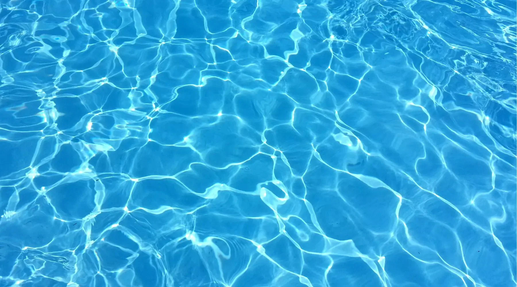
On the swimming pool front, something seems to be wonky with our SWG today. This morning, I went out and noticed that the temperature sensor was reading 5-8 degrees higher than the actual water temperature. I calibrated it to match, but I’ve never had to do that before. I ran a test, which showed normal cell amps, but then after I exited the menu, the display started flashing a low amps warning. Not sure if the two issues are related. The temperature thing is usually related to the tri-sensor, but the low amps thing usually points to the cell, so I’m not sure what to make of this. I power-cycled the controller and also backwashed the filter, but neither helped with the temperature anomaly. The low amps display went away after a minute or so, but the Chlorine has been running a little lower than expected this week, so I wonder if this has been happening for a few days. This evening, I’ll pull the cell out and inspect it, and I’ll also look at the check valve and see if there’s anything impeding flow through the tri-sensor. The cell is 14 years old, and has outlasted the original controller and tri-sensor, so it could be that it’s finally time for a new cell. However, it doesn’t seem like a bad cell would cause the issue with the temperature reading. I’m sure I’ll get to the bottom of it, and I’m sure it’ll end up costing me more money. That’s just life with a pool.
-
Weekend Ride
I rode through parts of Columbia, Savage, Laurel, and Jessup this morning, for a round trip of almost 40 miles. I usually plot my routes on gmap-pedometer.com ahead of time to get a rough estimate of distance, but I did not do that for this ride. I had guesstimated it at roughly 30-35 miles, which I guess was too low. Nice to get out for a longer ride, though. It was a fairly flat route, so I took my single speed bike. I was out for right around 3 hours, and found 4 geocaches along the way. The weather was nice: it started out in the upper 60s with a dewpoint in the low 60s, which felt great compared to the past 3 days. A line of strong storms passed through the area yesterday evening just ahead of the cold front. Most of the action must have been to our south, as there was a lot of storm debris in the roads, particularly around Savage.
Based on the weather forecast, it looks like I might be able to ride my mountain bike to work on Wednesday, for the first time in forever. Looking forward to that if it happens.
-
Biking Notes
Today, I took an out-and-back trip from Bethany Beach to Isle of Wight Park near Ocean City, MD. It was the first of (hopefully) 2 or 3 rides at the shore this week. My round trip distance was just under 34 miles. I rode my Masi single speed bike, which is my favorite bike to ride in coastal areas, as the flat terrain makes multiple gears mostly unnecessary. It was a really nice day for July on the east coast, but traffic has really picked up along this route in the post-COVID years, particularly near the town of Bayard. Once I crossed the border into Maryland, the roads quieted down, and I was able to enjoy the ride a little bit more. My main reason for visiting Isle of Wight park was to find a “Cache Across Maryland” geocache, plus a bonus cache. I skipped a few other caches in the area because they were back in the woods, and I forgot to bring bug repellent, which is a necessity around here this time of year, unless you really like ticks and mosquito bites.
This was likely my longest ride of the week. The next time I get out, I’m planning on riding east to Frankford, which is about a 20-25 mile round trip. If I can get out a third time, I’ll either head north toward Holt’s Landing, or south to Fenwick Island.
-
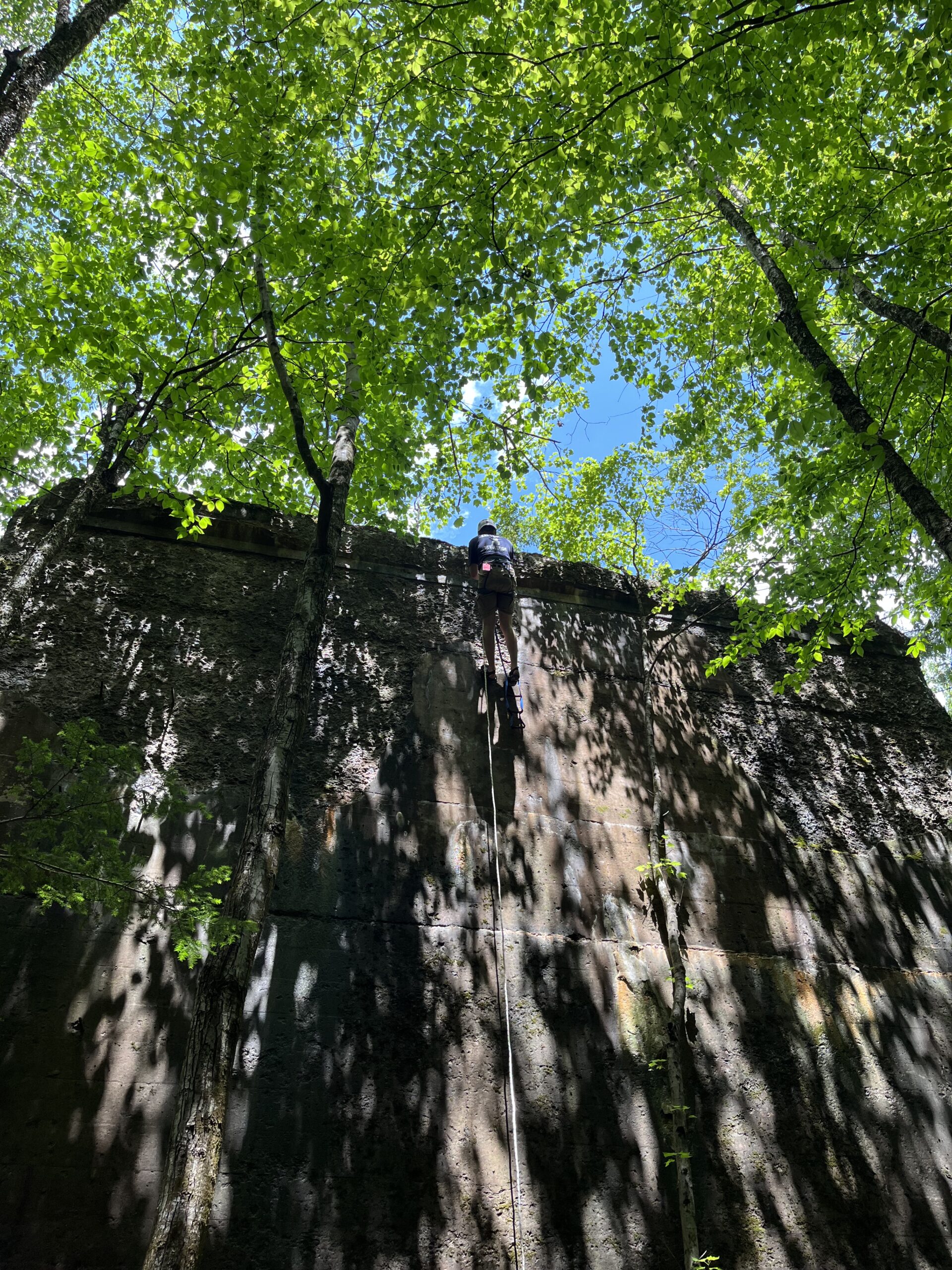
Pillar Climbing
I drove up to Pennsylvania yesterday to find a geocache at the top of a 30′ pillar. This is the third like this I’ve found, and a popular type of “extreme” cache hide. Most of these old pillars carried railroad tracks “back in the day”, which have since been abandoned, but the pillars (built to stand the test of time) remain, usually alongside or in the middle of rivers. Many of them have caches on top. These caches typically aren’t found very often — while there are a large number of people with the skills and equipment to ascend pillars, and also a large number of geocachers, the intersection of those two sets is relatively small. The cache we found yesterday had not been found in 4.5 years.
Typically, to climb these, you need to shoot a line over the top of the pillar, use it to pull a rope over, anchor the rope, ascend the rope using appropriate gear, and then rappel back down. Sounds deceptively simple, but throw in a fast-moving stream or river, trees to snag the line, nooks and crannies at the top where the rope can get stuck, etc., and setting the rope can get tricky. Ascending up can be physically challenging, and the technique takes some practice to master. Getting up over the edge takes upper-body strength, and rappelling back down can be scary. But it’s a great adrenaline rush, and a real feeling of accomplishment when you succeed.
I’ve used a different rappelling technique with each of the 3 pillars I’ve climbed. The tricky thing about these is that the rope is typically very low — most often running across the top of the pillar, at foot level as you start. The first technique was shown to me by someone with a lot of rope experience. You start by standing up, legs straight, with a low center of gravity, and slowly pivoting backwards until you “pop” onto the wall. It’s really cool, but really scary. With method two, you sit on top, legs dangling off the side, and then kind of roll yourself over into rappel position. Less scary, but fewer style points.
The third method, which I used yesterday, worked out well. We put an ascender on the rope above the rope protector, attached a rope (actually webbing) ladder, and dangled it over the side. I got into position by grabbing the ascender and stepping down onto the ladder to get below the rope. Not sure it will always be possible to rig this, but I felt more confident with this method than with the other two.
Anyhow, every time I do one of these, it whets my appetite to more. I hope to get a group together to tackle another one of these in the not-too-distant future.
-
Ride Notes
2023 marks the 15th anniversary of when I started using a bike as my primary method of commuting to work. Nowadays, I only go into the office once or twice a week, so I’m not bike commuting nearly as much, but I’m happy that I’m still doing it, and I almost never drive my car to work any more. In fact, I’ve been able to save some money by ditching my annual parking permit in favor of pay-as-you-go daily permits.
Today, I rode through Catonsville, which I haven’t done much lately due to the Grist Mill Trail closure in PVSP. With school out for the summer, there’s less traffic on the roads, so I rode through Ilchester and out River Road to Oella, where I picked up the #9 Trolley Trail. I then rode Edmondson Ave. out to Ingleside Ave., found a geocache off Harlem La., and headed to UMBC via Prospect Ave., Short Line Trail, Kenwood Ave., and Wilkens Ave. I’ve ridden on all of these roads before, but never this exact route. The weather was cloudy, windy, and drippy. I wouldn’t call it rainy, but it sprinkled almost the entire time I was out. I ended up putting my rain jacket on when I stopped for the cache, as I was actually getting chilly. It definitely was atypical weather for the first day of summer. My watch tells me I rode 17.33 miles, which is a couple miles longer than my usual commute through PVSP and Halethorpe/Arbutus. All in all, not a bad ride.
-
Today’s Ride Notes
I’m trying to start using my long-neglected blog kind of like a daily journal. We’ll see if I keep up with it.
Ever since COVID hit back in 2020, I’ve been doing more weekend bike rides, combining them with geocaching. Prior to that, I used my bike almost exclusively to commute to work. I still commute by bike, but not nearly as much as I used to, so these weekend rides are a good way to get some more biking in.
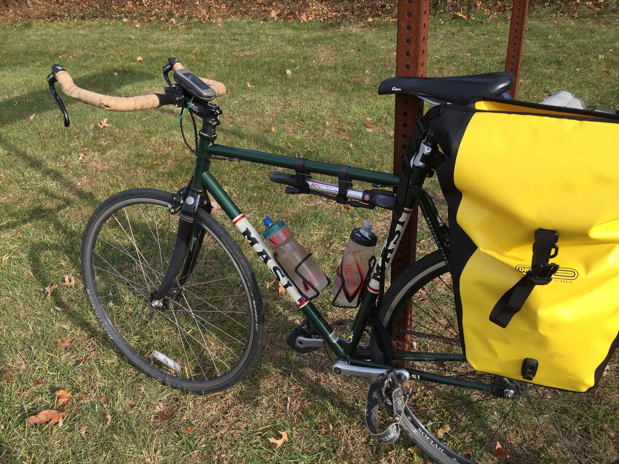
Today, I rode a 32 mile loop, which included some areas where I hadn’t previously biked: BWI Trail to B&A Trail, then back to Linthicum via Marley Neck Blvd., Fort Smallwood Rd., Hawkins Point Rd., Pennington Ave., and Ordnance Rd. Ordnance through Glen Burnie is not a route I would typically recommend, but it was doable early on a Sunday morning. The rest of the ride was great, and I found 5 caches along the way. I rode my Masi single speed for the first time in several months. The bike had been out of commission because the valve stem on the rear tube had broken, and I was out of tubes that fit the wheel. It took me a few months to get around to buying new tubes, putting one on, and reinstalling the wheel. Also, last year, the bike shop rebuilt the front wheel, because I had been breaking a lot of spokes. I wanted to take a few longer rides on the bike before I take it to the beach later this summer, just to put the wheel through its paces, although I’ve taken several rides on it already. So far, so good.