We are now about halfway through May, and after a warm April, the temperatures have been below average for the past several weeks. It looks like we will be getting back into the 90s next week, so this may be spring’s last gasp. Earlier this spring, we had our old, ailing central A/C replaced with a high efficiency heat pump, and we’ve been trying out the heat during some of the colder mornings. I think the heat pump will save us a lot of money on heating oil during the winter, but how well it performs during really cold weather remains to be seen.
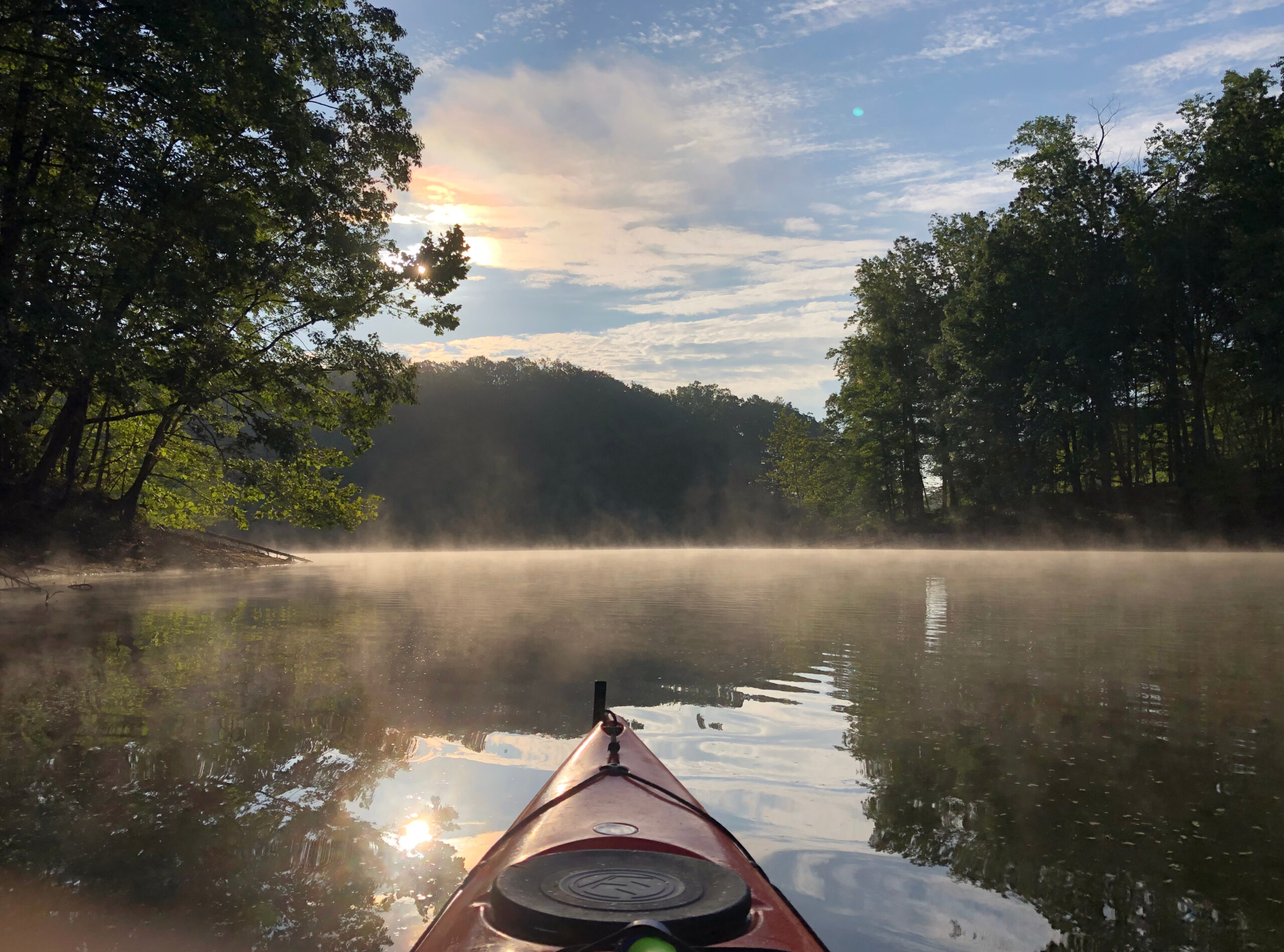
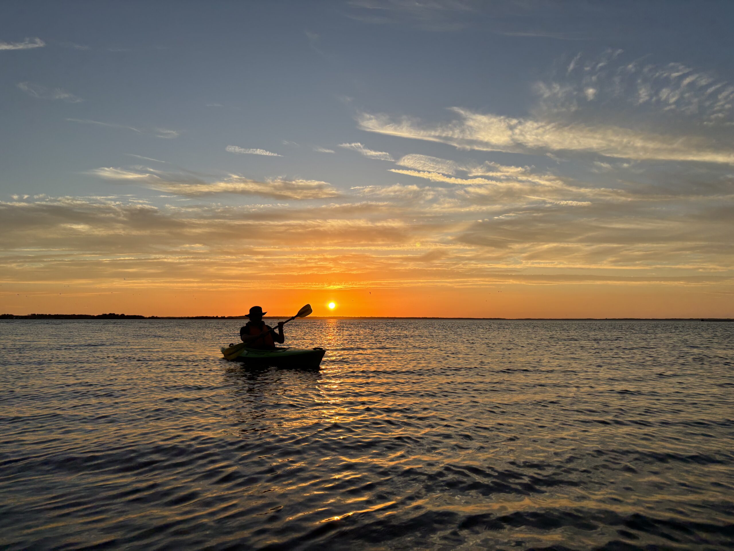
I have been out paddling for the past 3 consecutive Monday mornings, and each time, I have worn my wet suit and spray skirt (the latter most recently because it was raining, and earlier because of gusty wind/choppy water). I don’t recall using the wet suit this late in May before, but the water temperature (per NOAA’s Baltimore inner harbor buoy) has been hovering in the low to mid 60s, and my cutoff for wearing the suit is upper 60s to around 70. That’s also the temperature at which I’ll consider using the SUP instead of the kayak. Based on the forecast, I suspect I’ll be out on the SUP within the next week or two.
We will likely be opening our pool in the next couple of weeks. After sealing up around the underwater light niche conduits a month or so ago, the pool seems to be holding water, but that doesn’t tell me much, as it typically only loses water when it’s at or below freezing. So, the real test will be to see if it leaks this coming winter. I also plan to inspect the main drain this spring once the pool is open, to make sure the hydrostatic relief valve port fitting (another potential winter leak source) is still sealed up properly. I started the pump up a couple of weeks ago, which went off without a hitch. I still have a slight leak on the pressure side around the pipe threads. Last year, it eventually stopped leaking on its own, so I’m tempted to wait it out again this year rather than taking everything apart to re-seal (which is admittedly easier now since I put unions in). I’m always paranoid about creating larger issues while trying to fix small issues. 😀 I also have a small leak around the handle shaft of the filter multi-port valve, which already seems to be stopping (there’s water at the base of the handle, but nothing dripping on the ground). I’ve been considering replacing that valve, but that can likely wait until fall. In preparation for opening, I’ve added 360 pounds of salt so far, and will likely need another 80lb or so, plus 10-15lb of stabilizer, before we take the cover off.
It has been a rather light spring for biking, and when I have gotten on a bike, it’s been one of my mountain bikes. While droughts are mostly bad, they do make for good trail conditions (as long as we get some occasional rain to keep things from getting too dusty). This is “bike to work week”, so today, I did my duty as a long time bike commuter and rode to the office, although I was mostly on single track trails. The older I get, the less appetite I have for riding in traffic, so I tend to gravitate towards mountain biking whenever conditions allow. This weekend, though, I’m hoping to get back into my summertime tradition of taking long road rides to find geocaches. Bikeable caches have been popping up left and right over the past several days, so I’ll have plenty to keep me busy.