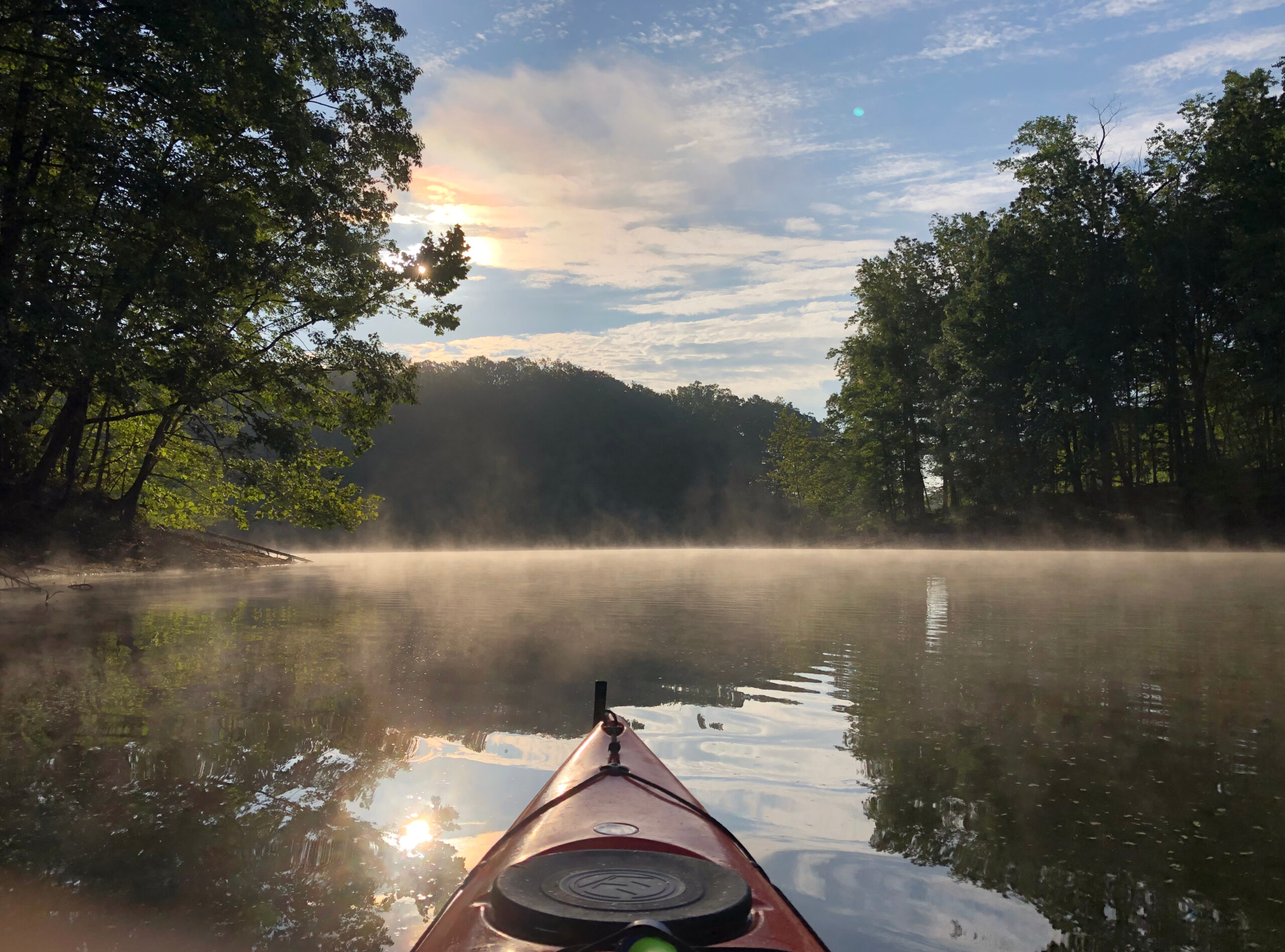
Delaware Paddling Report

I managed to get out paddling 3 times during my recent trip to Bethany Beach, DE, all in under 48 hours!! Here are some quick notes.

Delaware Breakwater East End Lighthouse: Launch is in Cape Henlopen State Park right next to the fishing pier. Need to go early-ish in the morning to avoid bad traffic through Rehoboth. $10/vehicle entry fee for out-of-state tags, paid at an automated kiosk (credit card only). We put in around 8:00am, near high tide. Total paddle was only around 2.5 miles, but lots to see along the way: dolphins, horseshoe crabs, an osprey with chicks, Lewes-Cape May Ferry route a short distance away, and (of course) the lighthouse. Water was nice and calm behind the breakwater, with occasional minor chop from boat wakes and breeze. There were a fair number of people out on the water: a few fishing boats, a whole bunch of kayaks (a few people fishing, and what appeared to be a sightseeing tour). We were able to disembark on the breakwater, walk up to the lighthouse, and find a geocache that was hidden there. It’s not for the faint-hearted, though: there is nowhere to easily tether the boats, so we roped them together and took turns. All in all, a very memorable outing. It would be a great place for sea kayaking.

Savage Ditch: This is north of Bethany about a mile past the Indian River Inlet Bridge. We came here in the evening. This is also $10/vehicle for out-of-state, paid at an honor box. I missed the launch at first and tried to follow the trail past the picnic pavilion, which was a mistake. It does go to the water, but it’s several hundred feet, and the bugs were fierce. I was swatting them the entire way, and picked up two ticks. My son found the actual launch, which is a much shorter carry and somewhat less buggy, but the put-in is on the muddy side. Once on the water, though, it was quite nice. We saw tons of gulls, lots of water turtles, and a few egrets, terns, and ducks. We didn’t paddle too far since it was close to dusk. The sunset was very nice, as was the near-full moon. Next time, I won’t forget the DEET.

Trap Pond State Park: After years of hearing people rave about this place, we finally decided to check it out. It is about a 40 minute drive from Bethany with light traffic, or 45-50 minutes with heavy beach traffic. Unfortunately, the trip was kind of a bust, as the water level was extremely low to accommodate emergency repairs to the dam. As a result, most of the really cool places to paddle were inaccessible due to shallow water. Had I done my homework ahead of time, we probably would have taken a pass this year. All the same, we did get a couple miles of paddling in, and we saw some really cool bald cypress trees. We will come back here at some point when things are back to normal.

Second and third paddle outings of the season

So far, I’ve done well with my informal New Year’s Resolution to get out on the water earlier in the season. I’ve been out the past three Tuesday mornings, each time launching from Solley’s Cove Park. Last week, I paddled most of the way down Marley Creek, which is the longest creek upstream of the launch. Cathy came along as well. The last time I paddled here was early November 2022, and that day, I identified several potential hiding places for a geocache series I’m thinking about putting out. I checked each of the sites last week, and all but one still seemed viable. I have yet to paddle all the way to the headwaters of Marley Creek, which looks like around 6 miles round-trip, or a little bit farther if I check out all of the side channels along the way. Today, I paddled Furnace Creek and Bell’s Cove, which lie to the north of Marley Creek. I am pretty sure I did the same paddle last year — it’s a shorter creek than Marley, so I paddled all the way to the headwaters. My somewhat meandering route ended up being 5.4 miles round trip. I identified a few geocache sites along here as well, though there aren’t as many good ones as there are along Marley. A lot of the shoreline is severely eroding, a huge amount of it is developed (as is the norm in Anne Arundel County) and some of the more natural areas have posted private property signs.

I am working on trying to find a good setup to haul 2 kayaks plus our new SUP on the van at the same time. It looks like I can fit J-hooks for two kayaks outside the rack towers on either side of the van. The SUP mount should then fit in the middle. I have a love-hate relationship with J-hooks, as it seems like about 50% of the time, I don’t get the kayak side-on enough when I’m hefting it up there, and it ends up partially horizontal, requiring me to “finesse” it back and forth until it slips into the J-hook, all the while hoping it doesn’t fall. If I can get my loading technique down, I suspect the hooks will work OK on the van, though, at least for the short term. The Thule Hullavator loader looks nice, but I don’t think I’d be able to get two of them up there in addition to a SUP mount (and they cost $900 each). A trailer is another option, but most of them can’t accommodate a 16-17′ sea kayak. So, at least for now, I’m back to the J-hooks.

Also on the subject of kayak loading, as often happens this time of year, I’ve managed to tweak my lower back. My back is in remarkably good shape for all the abuse I’ve put it through over the years, but I’m not in my 20s any more, so I have to be more careful with it, which means not bending over and lifting heavy stuff (the old “lift with your knees” cliché). I’ve found that when my back is acting up, it doesn’t like me picking anything heavy up off the ground at all, whether I “lift with my knees” or bend over at the waist. That presents an issue with loading kayaks, as they’re heavy, and they’re usually on the ground. For today, I took the J-hooks off the Honda Civic and put a set of cradles and rollers on that had been on the van. Then, I used a rope extension on the kayak’s pull handles, so I could lift the boat up one end at a time without bending at all. Finally, I used my trusty boat loader extension that slides out of the crossbar and supports one end of the kayak while I lift the other side up. The combo worked out pretty well, and I managed to do my loading and unloading without aggravating my back.

First paddle of the season

Last year, I didn’t take my first paddle until early June, effectively missing out on a couple of months of nice paddling weather. One of my resolutions for 2024 was to get out paddling earlier in the spring, and I was able to make it happen yesterday morning. Spring paddling can be tricky, because while the air temperatures are warming up, the water temperatures tend to lag behind, which is often the reverse of what happens in the fall. When I’m looking to get out, I usually check the BLTM2 buoy to get a general sense for area water conditions. It’s located at the mouth of the Patapsco just north of Fort McHenry, and I’ve found it to be a fairly good gauge of whether the water will be warm enough for paddling in the various estuaries around Baltimore City and Anne Arundel County. Yesterday morning, the water temperature was just under 60ºF, and air temperature was in the low 40s, which was ideal, because it allowed me to dress appropriately for the water temperature without getting all hot and sweaty. I wore my wet suit with paddling jacket, paddling boots, paddling socks, and pogies attached to my paddle. It was my first time wearing the jacket and the boots. The boots (NRS brand) worked out well. They come up past my ankles, and I liked that the extra height kept water from washing inside while I was wading around the launch during put-in and take-out. They also have some fleecy insulation which kept my feet warm, and should work out nicely over a dry suit as well. I think I’ll probably save them for colder weather, and stick with my NRS Kickers or Vibram FiveFingers during the warm part of the season.

As for the paddle itself, I put in at Solley’s Cove Park and went into Tanyard Cove and back, for a total distance of about 3.5 miles. It was just far enough to get me warmed up for the season. I saw a bunch of deer swim across the water at one point, as well as a rather ill-tempered snapping turtle, and the highlight of the day was a bald eagle that had me wishing I had brought binoculars. I won’t forget them next time!

Stoney Creek Paddle

I had been hoping to get out for one more paddle this season, so I was happy I was able to make it happen this morning. I decided to check out another new-to-me launch, namely Green Haven Wharf in Pasadena. This is about 20-25 minutes from home (depending on traffic) and provides access to Stoney Creek. Last year, as part of a larger improvement project, Anne Arundel County added a nice car-top boat launch. Before that, it looks like there was an unofficial launch that was a short carry from parking. It is free to launch here, and there is parking for several vehicles, but no bathroom facilities. With air temperatures in the mid 50s and water temperatures in the upper 50s to low 60s, I opted to wear my wet suit. I hit the water at around 9:00am, and was out for two hours. The day started off overcast, but the clouds burned off while I was out, and I finished the paddle in bright sunshine. While it was a beautiful day to be on the water, it was definitely on the windy side. I started out by checking out a couple of small coves just upstream of the launch, but soon ran out of real estate and turned back downstream. My initial goal was to paddle all the way out to the Fort Smallwood Rd bridge, but I ended up turning around a little bit short of it, because the water was getting choppy and I was fighting against the wind. With the wind at my back, I headed back in the direction of the launch, and checked out a couple of smaller coves along the way. The water was fairly calm here, and it was quite enjoyable. I saw a couple of kayak fishermen out at one point, but other than that, I had the water entirely to myself. All in all, I covered around 5 miles.

I’m pretty sure this was the latest in the season that I have ever paddled. I’d lay odds on this being my last paddle of the season, but you never know. In any case, I really enjoy being out on the water this time of year, and I could see myself eventually buying a dry suit and getting into year-round paddling. Probably not this year, though.

Crab Creek Paddle

This morning, I headed back to Homeport Farm Park (near Edgewater) to paddle, for the second time this year. The launch is along Church Creek, a small tributary of the South River. It also provides easy access to Crab Creek, another tributary just to the east. Being 30-35 minutes’ drive from home, this ordinarily wouldn’t be a frequent paddling location for me. However, back in 2020, I adopted a couple of geocaches along Church Creek, and have since placed several more here as well, so I typically come here once or twice a year to check on them. Today was another very mild day, with highs in the 70s. However, based on the forecast, this may be the last time this season that I paddle without a wet suit. I hit the water at 8:30am, and hardly anyone else was out. No other cars were parked at HFP when I arrived, or when I left 2 hours later. I saw one boat speed by on the South River, way off in the distance. There were a few sailboats still anchored from overnight. All in all, a pretty quiet morning on the water. It definitely pays to get out early, especially on weekends.

When I come here, I often start by heading upstream on Church Creek, but today, with a receding tide, I opted to head out to the river and paddle up Crab Creek instead. While I had paddled out to the mouth of Crab Creek before, I had never gone all the way upstream. The round trip was about 5 miles. It’s typical Anne Arundel County coastline, with lots of development, and a few natural areas mixed in, particularly around the shallow headwaters. The fall foliage is nearing its peak, and there were a lot of leaves floating in the water. It’s a great time of year to paddle. I hope to get out one or two more times this year, but we’ll see if the weather and my schedule will cooperate.

Paddling Report

Now that fall is well underway, I’m trying to fit as much paddling in to my schedule as I can before it gets too cold. Today, we headed to the eastern shore, put in at the Wye Island public canoe/kayak launch on Granary Creek, and paddled out to Pickering Creek Audubon Center and back. The total distance was around 6.5 miles. A large portion of the route was on the Wye River. This stretch had a lot of boats, most of which were stationary or slow-moving and appeared to be fishing or crabbing. We did not see any recreational boat traffic, and only had to deal with a very occasional wake. Weekends might be a different story, though. Once we entered Pickering Creek, we had the water to ourselves. We paddled until it got too narrow/shallow, then turned around, and I took out briefly at the Audubon Center and found a cache. There is a canoe launch next to the boat house, although the take-out is a little bit tricky because it is at a set of stairs (similar to the Wye Island launch, actually). It was nice to get out and stretch before paddling back. We had a slight headwind the rest of the way, but not enough to really slow us down. I was still dragging a bit from the cold I’ve been battling for the past 3 or 4 days, but I wasn’t going to let that stop me from getting out on the water on a beautiful day, especially at this point in the season. Although I was slowing down somewhat by the time we finished, I felt OK for most of the paddle. It probably helped that I slept almost 10 hours last night.

One of these years, I would like to come here and circumnavigate Wye Island. I read somewhere that it is 12 to 13 miles, which is definitely doable, especially if there are places to take out periodically and stretch.

A few quick notes about the Wye Island launch: while there are picnic tables and grills, there are no bathroom facilities. Launch is at the bottom of a set of stairs. There is a kayak ramp to facilitate put-in, but need to bring rope to use it effectively. Put-in will be easiest at low tide. Closed November through March for wintering waterfowl.

Park run

Humidity is back in central Maryland for the time being. No one was available to climb this morning, so I decided to take a rare Friday run instead. Once again, I took a pass on school-day traffic and ran in the park. I extended the run to around 8.5 miles by running all the way out to the Ilchester bridge and back on the Grist Mill Trail. I could extend this route to 10 miles rather easily, by crossing under the railroad tracks near Lost Lake, and running out past the Soapstone trailhead to where the road ends and back. My right hamstring is still stiff. I stretched it out a bit by doing some sprints towards the end of the run, which was uncomfortable, but I think will be good for it in the long term. Depending on the weather, I may take a shorter run tomorrow as well.

Random kayaking note: a post on Facebook clued me in to another place to paddle in A.A. County: Stoney Creek from Green Haven Wharf in Pasadena. At 25 minutes’ drive, it’s a bit farther than Solley’s Cove, but might be a nice place to check out, either in the coming weeks, or next year. Looks like it would be a 4-mile round trip paddle to the Fort Smallwood Rd bridge and back, with several side creeks to optionally extend the voyage.

Paddle Notes

I got out for my annual paddle along the tidal Patapsco this morning, putting in at Southwest Area Park at around 7:45am, just before the 8:00am predicted high tide at Fort McHenry. I paddled about 3.5 miles upstream and back, for a total of 7 miles, which I believe is a new distance record for me on this particular stretch of river. Usually, shallow water prevents me from getting too far upstream of the B/W Parkway overpass, but today, the water was navigable all the way past the Baltimore Beltway overpass. I could have gone farther, but ended up turning around because I wanted to be home by 11.

Southwest Area Park was quite busy this morning with people launching, fishing, etc. It was the first time I had been there on a weekend in several years. To be honest, I had been kind of avoiding it on weekdays recently, because there always seemed to be sketchy people hanging around using various substances, etc. I may stick to weekends going forward, as I did not get that vibe this morning.

This part of the river has not changed much in the year since I last paddled here. On the upstream leg, the stretch between the launch and the MD 648 overpass was stagnant and murky, with no current at all, and a dismaying amount of trash floating around. It really made me wish I had brought some trash bags, and I’m going to try to remember to do that going forward. On the return leg, the breeze had picked up and the water had a few more ripples (as well as a couple of wakes from small boats). I also noticed a lot less trash — way too much to have blown anywhere in that short amount of time — so I am thinking someone must have picked a bunch of it up, which makes me feel a little bit better about the state of humanity.

The best part of the paddle was the stretch upstream of 648, out towards 295 and 695. This part of the river has a little bit of a current, and the water is much clearer as well. It can be a challenge to navigate the shallow sections, but it was much easier today at high tide. I turned around just shy of the Halethorpe Ponds area, which is somewhere I have been wanting to check out as both a paddling area and a potential put-in. I am curious if it would be possible to get as far upstream as US 1 and the Thomas Viaduct. I suspect I won’t find out until next year at the earliest, but you never know.

Paddling Again

We finally got out paddling again this morning, for the first time since mid July. While I’m normally not a huge fan of paddling during the dog days of summer, most years I do get out at least once or twice through late July and August, so this year was a bit of an anomaly. In my opinion, September and October are the best months of the year for paddling in this area, but this September kicked off with a massive heat wave that was great for swimming in the pool, but not so great for paddling. Looks like the sweltering weather is behind us for now, so going forward, I’m hoping to get out about once a week, until it gets too cold.

Today brought us to Solley’s Cove Park in Anne Arundel County, where I have launched numerous times. It’s one of my “go to” places when I’m looking for something 20 minutes or less from home (if I recall, I took my last paddle of 2022 here). This used to be an unofficial “locals only” launch area that was accessible by parking at the nearby American Legion, and carrying the boats down a 100′-or-so path to a small sandy beach. That access point is still there, but a couple of years ago, the county built a public boat ramp, soft kayak launch, and parking area, which is a much nicer and more convenient place to launch. I suspect it’s more popular on weekends now, but it was very quiet on this pleasant, breezy Thursday morning. There are lots of places to paddle here, but today, we headed upstream to Furnace Creek, paddling all the way out past Rt 10, and continuing until it got too shallow. Our total distance was about 4.2 miles — not the longest paddle in the world, but enough to scratch the itch. I won’t be able to paddle next week, but hope to get out one morning the week of the 25th to paddle a little bit on the Patapsco River.

Morning Paddle Notes

This morning, we launched the kayaks at Sassafras Landing and paddled around 5 miles on Miller Creek, which feeds into Little Assawoman Bay. Nice paddle with plenty of wildlife, particularly birds, including herons, cranes, and ospreys. It’s definitely important to get out early this time of year to beat all of the recreational boaters. It was pretty quiet when we launched at around 8:15am, with just a few other boats and personal watercraft out, but it was definitely getting busier, and heating up, as we took out. Sassafras landing is a nice put-in from a sandy beach, but there are many other options for accessing this body of water. Four years ago, we put in at the Kent Ave ramp in South Bethany, which is on the Assawoman Canal to the north. In 2021, we launched a little south of here from the dock behind the house where my brother and sister-in-law’s family was staying. On the south side of the peninsula where we launched today is Mulberry Landing, which looks like another boat ramp. Next time we paddle here, I might check one of these other locations out. Once again, though, definitely need to get out early — preferably before 8:00am.